Exports & Compliance
Large-Scale Polygon Mapping for EUDR-Compliant Natural Rubber
Tens of thousands of smallholder rubber plots, one deforestation-free claim per shipment, and a due diligence statement that has to be filed before every EU entry.
The challenge
- Natural rubber reaching a tyre or industrial manufacturer typically passes through dealers and processing units that pool latex and sheet from thousands of independent smallholdings, most under two hectares.
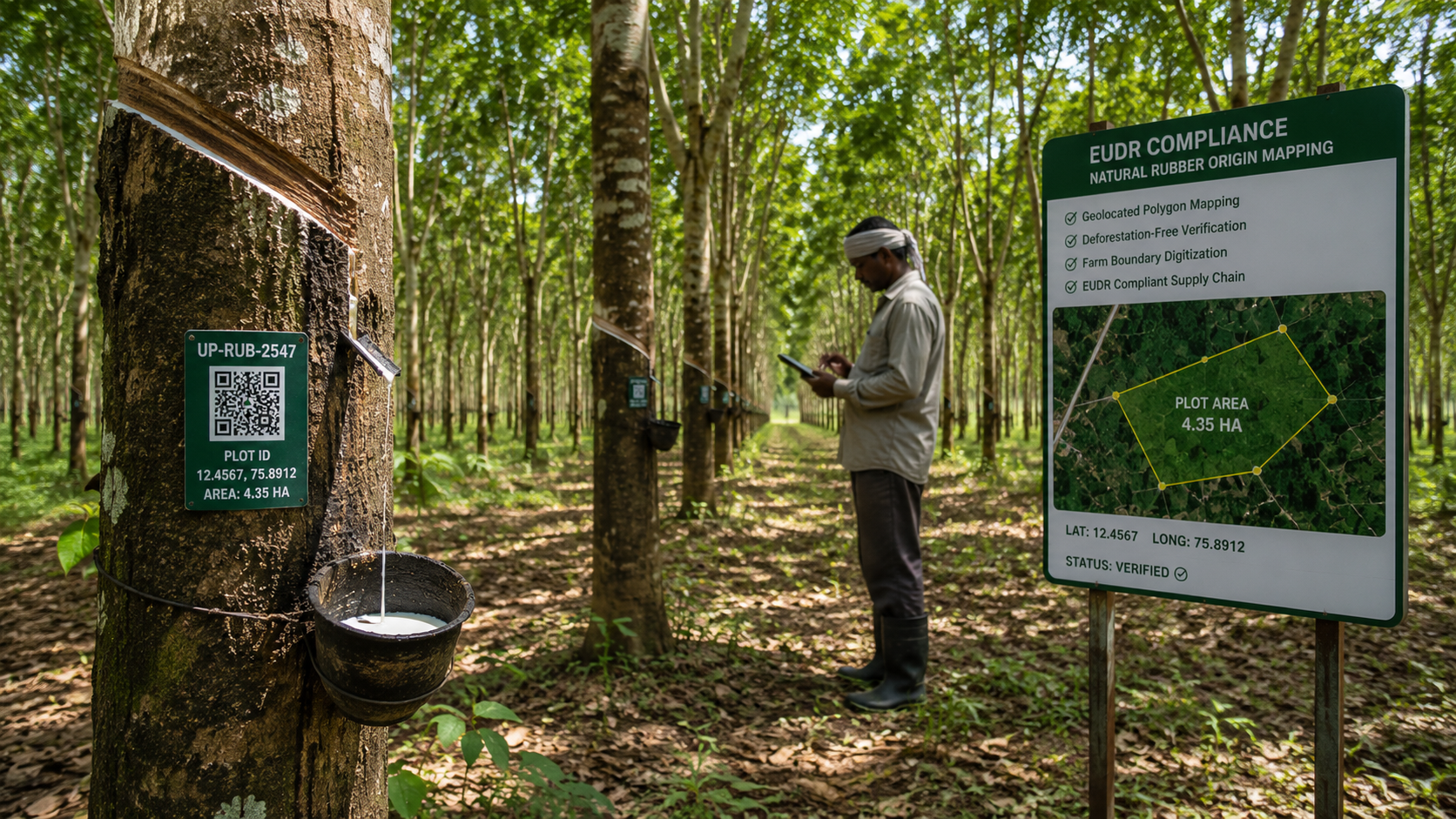
- EUDR requires polygon geolocation for every production plot above four hectares and a defensible land-use assessment from the 31 December 2020 cut-off — neither of which exists in a chain where the buyer knows only the dealer.
- Supplier lists arrive as spreadsheets with village names rather than coordinates, and manual reconciliation across tens of thousands of rows is slow, error-prone and impossible to re-audit.
How the platform solves it
Mass plot mapping with validation at capture
Field teams walk boundaries using the offline mobile app, capturing polygons with accuracy flags in areas with no connectivity. Geometry validation runs at the point of capture — self-intersections, implausible areas and overlaps with previously registered plots are rejected before the record is accepted, so remediation happens while the officer is still in the village.
Bulk supplier data consolidation
Existing supplier registers, KML files and legacy spreadsheets are imported and reconciled against newly captured polygons, so historical relationships are preserved rather than rebuilt. Duplicate detection uses plot geometry as the primary key, catching the same smallholding registered under different spellings across dealers.
Deforestation cut-off validation
Satellite land-cover analysis runs against each verified boundary from the cut-off date to the present, producing a per-plot deforestation-free assessment with imagery dates and method recorded as an evidence file — not a status flag.
Batch-linked due diligence statements
Intake at the dealer and processing unit is recorded against batch identifiers linked to contributing plots, so each consignment resolves to its plot set automatically and a TRACES-ready Due Diligence Statement package is generated in a single click.
Outcomes
- Plot-level geolocation across the full supplying base, not a sample
- Per-consignment deforestation-free evidence instead of a blanket declaration
- Due diligence statements generated in minutes rather than assembled over weeks
- A five-year retrievable audit record aligned to the regulation’s retention requirement
See this configured for your supply chain.
A 30-minute walkthrough with your commodity, geography and compliance obligations on screen.
Book DemoRelated use cases